Mon Towns Trail Guide
Summary
With hundreds of unique recreation destinations just a short drive from any of our Mon Forest Towns, it's no surprise you'll encounter a variety of trail types when exploring wild and wonderful West Virginia! Whether you're looking for a short trek or launching a weeklong expedition, we're here to share some of our favorites!
Trying to track down the perfect trail across nearly one million acres of the Monongahela National Forest can be a tad overwhelming, so in this Mon Towns trail guide, we’ll be reviewing the types of trails you may encounter in the Mon, what you can expect, and a few of our favorites!
Remember to stay safe when exploring the Mon and Leave No Trace to help preserve these amazing natural and cultural resources for future generations!
Trail Systems
What do Los Angeles, CA, Little Rock, AR, Washington DC, Boston, MA, and Davis, WV all have in common? A very determined hiker could technically step foot in each city without ever hoping in a car, train, or plane! A trail system is simply a network of interconnected pathways, with each often offering different levels of challenge and recreational uses. At the broadest level, this means the Monongahela National Forest is just one part of the continent-spanning United States Trail System. From Peters Mountain on the West Virginia-Virginia border, the Mon’s own 311-mile Allegheny Trail connects to the Appalachian Trail, which in turn connects to hundreds of historic and scenic throughout the nation!
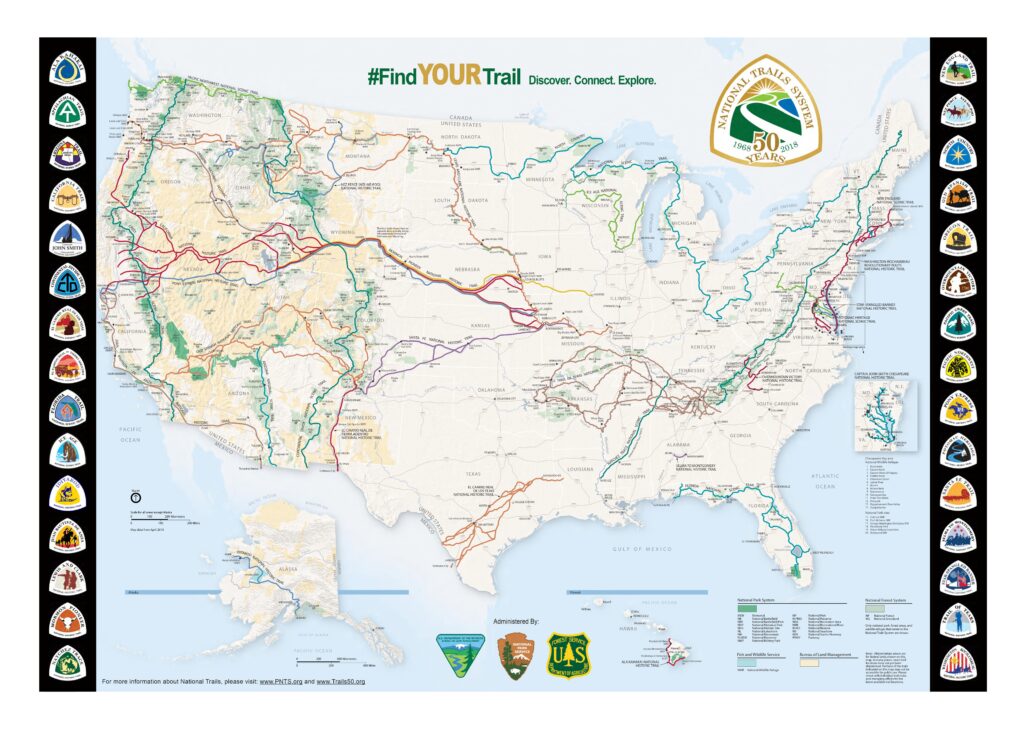
National Trails System Map. NPS
But you don’t need to trek across the country to enjoy the Mon’s trail systems. While many connect to the wider world, some of our favorite local trail systems, like those at Little Canaan, Blackwater Falls, and Mower Basin listed below, feature a central parking area and form self-contained loops, allowing hikers or bikers to customize the length and difficulty of their route.
Blackwater Falls State Park: 39.11262632543709, -79.48433676916669
Little Canaan Wildlife Management Area: 39.129633076075464, -79.45824370878948
Mower Basin Trails: 38.57197977226252, -79.92469302995607
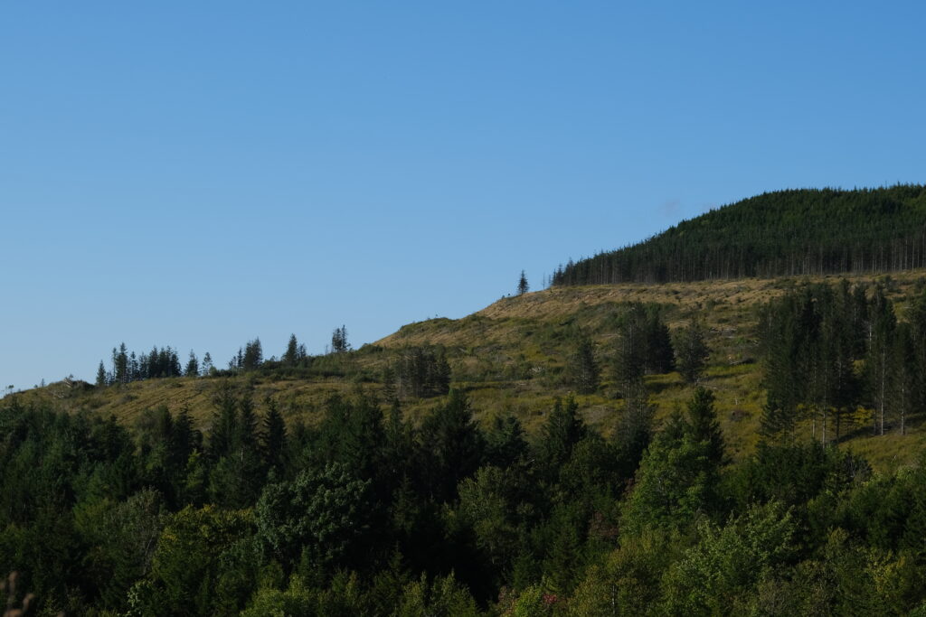
Hawks Ridge Loop at the Mower Basin Trail System
Loop Trails
Just like it sounds, a loop trail will bring you right back to the start! While many of the Mon’s loop trails, such as Gaudineer Knob, are shorter, interpretative hikes perfect for family outings, others, like the 5.5-mile Blue Bend Loop in the Big Draft Wilderness, offer a full day of fresh scenery on a single trail!
Gaudineer Knob Trail: 38.61564106871444, -79.84381018289987
Blue Bend Loop: 37.92085683059876, -80.26743423449369
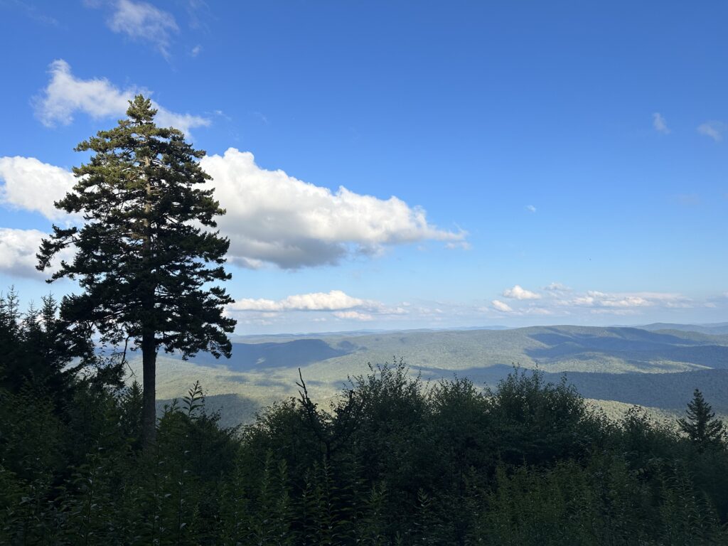
Scenic Overlook on the Gaudineer Knob Trail
Interpretive Trails
Focused on telling the story of the landscape and highlighting natural ecosystems, interpretive trails are commonly the shortest trails you’ll find when exploring the Mon- but don’t let their small size fool you! These trails are absolutely packed with interesting facts, clever puns, and opportunities to observe nature. On the 0.6-mile out-and-back Tea Creek Interpretive Trail, you’ll learn about ecosystem succession while passing through a gorgeous mountain meadow before descending into a beautiful wetland complete with two bird blinds! For history buffs, interpretive trails like the half-mile Cheat Summit Fort Trail and nearby Camp Bartow Trail provide a glimpse into the life of soldiers in the Civil War.
Tea Creek Interpretive Trail: 38.34143219481589, -80.16368827193206
Cheat Summit Fort Trail: 38.62225897227517, -79.8805956440743
Camp Bartow Trail: 38.53757915355549, -79.77296622209053
Tea Creek Interpretive Trail
Out-and-Back Trails
Also known as line trails, out-and-backs, as the name suggests, take you from the trailhead to a single destination and return using the same path. Although you’ll be revisiting some scenery, some of the Mon’s best-kept secrets lie at the end of an out-and-back trail! The nearly 8-mile hike on the High Falls of Cheat Trail brings you face-to-face with a roaring 100ft-wide waterfall, while a walk along the half-mile Falls of Hills Creek Trail descends several flights of stairs to show off three waterfalls, among the highest in West Virginia!
High Falls of Cheat Trail: 38.74957094577652, -79.75331316510469
Falls of Hills Creek Trail: 38.17848042579036, -80.33895130441826
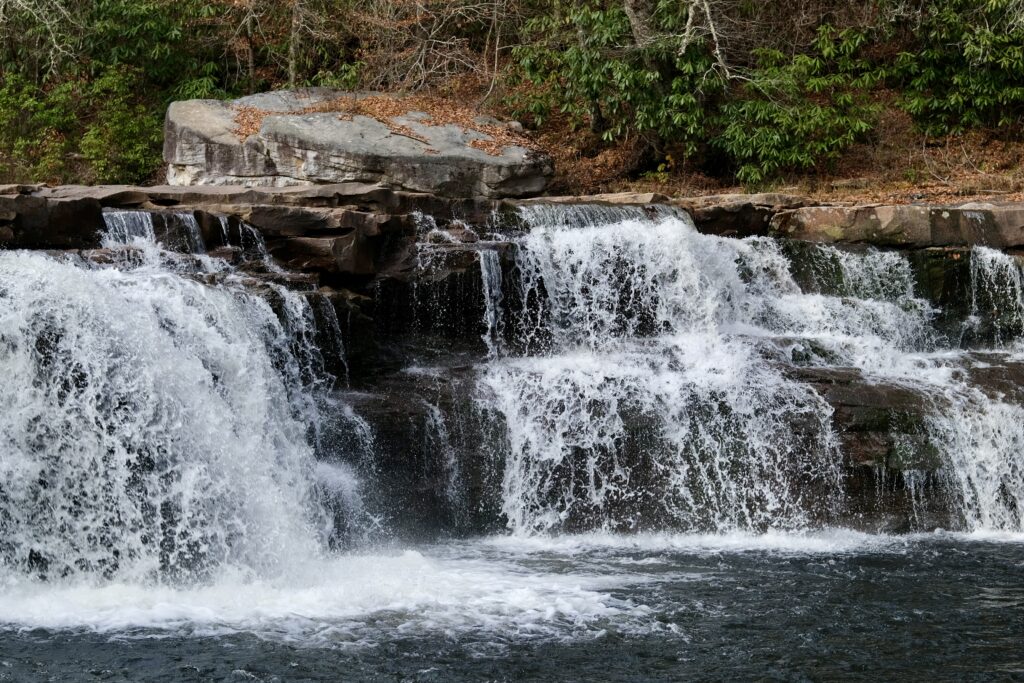
Waterfall at High Falls of Cheat Trail
Rail Trails
The Mon’s history is deeply tied to the arrival of the railroad at the turn of the 19th century, and while vintage locomotives still depart from Cass Scenic Railroad and the Elkins Depot, many unused rail lines still play a role in the endlessly wild and wonderful Mon through their conversion into long-distance, double-track, multi-use trails. Often following the river’s edge in the Mon’s lush mountain valleys, these rail trails offer some of the best bikepacking opportunities around. The 78-mile Greenbrier River Trail is the longest in West Virginia and features dedicated camping areas along the route; alternatively, riders can take on the 22-mile West Fork Rail Trail and learn lumberman-lingo as they pass through the Mon’s “Forgotten Towns.“
Greenbrier River Trail (North): 38.392147191783394, -79.92228890771159
Greenbrier River Trail (South): 37.794018308536245, -80.38022412260702
West Fork Rail Trail (North): 38.78864232841255, -79.72520921943273
West Fork Rail Trail (South): 38.55016419923451, -79.83112579504972
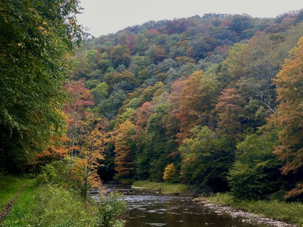
West Fork Rail Trail near Durbin, WV
Boardwalk Trails
With a unique climate and bog ecosystems normally found only in the far north, many trails in the Mon require special designs to protect nature and keep your clothes dry! Using wooden struts to elevate the path, ADA-accessible trails like the half-mile Cranberry Bog Boardwalk allow everyone to explore some of the best the Mon has to offer without literally getting bogged down!
Cranberry Bog Boardwalk Trail: 38.19849804974108, -80.27482675396614
Beartown Boardwalk Trail: 38.05212210998874, -80.27907356780082
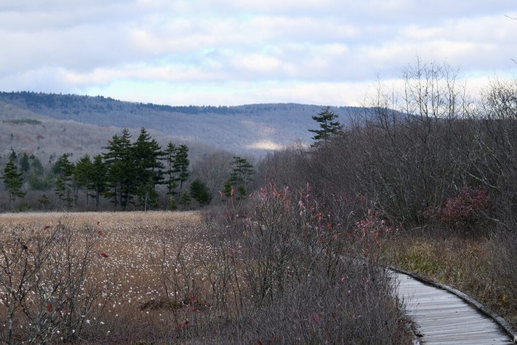
Cranberry Bog Boardwalk Trail
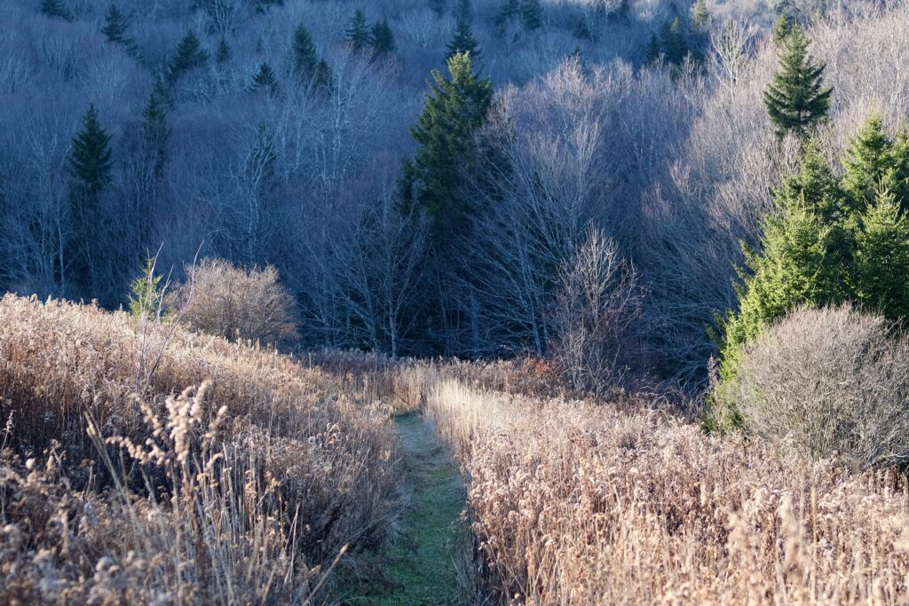
Backcountry Trails
For those hikers who don’t mind getting their maps out and boots dirty, the Mon’s eight wilderness areas are full of backcountry trails. Although this type of trail is generally longer and may receive less frequent maintenance, they more than make up for their ruggedness with an unmatched wild character. Two of the most popular backcountry areas include the +30 miles of trails in the Canaan Mountain Backcountry and nearly 60 miles in the Spruce Knob-Seneca Creek Backcountry!
Canaan Mountain Backcountry (Blackwater Falls State Park): 39.10777189825472, -79.49657170057496
Spruce Knob-Seneca Creek Backcountry (Spruce Knob Huckleberry Trailhead): 38.70197553256646, -79.53136117114856
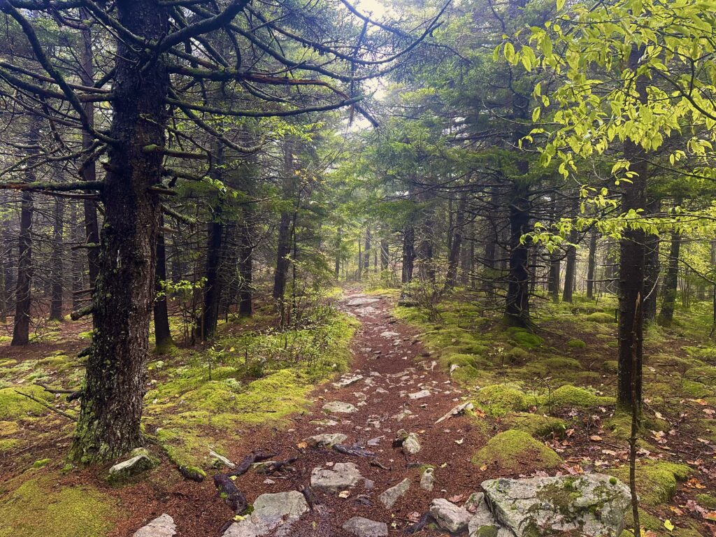
Huckleberry Trail in the Spruce Knob-Seneca Creek Backcountry
Trail Lingo
Blaze – Marks on trees, rocks, or a sign that indicates the trail route. Each trail will generally have a distinct color or shape that distinguishes it from other trails in the system. Most hiking trail blazes are rectangular
Cairn – A pile of stacked rocks that indicates the trail route, often constructed when the footpath becomes difficult to follow.
Spur – A branch off the main trail that leads to a dead-end.
Junction – The point where two trails intersect, usually featuring a sign or arrows to aid in navigation.
Tread – The trail’s surface material, including native soil, gravel, or pavement.
Single Track – A trail designed for one-way mountain bike traffic.
Double Track – A trail that can accommodate two-way mountain bike traffic; usually, these are former logging or mining roads.
Shared-Use/Multi-Use – Trails that are designed for various outdoor recreation options, ranging from trail running to hiking, biking, horseback riding, and cross-country skiing.